Providing energy consulting, GIS services, and project management to support a complex natural gas project in Papua New Guinea
The Papua New Guinea (PNG) Liquefied Natural Gas (LNG) Project developed gas resources and gas produced from existing oil fields in the Southern Highlands. The gas is conveyed by over 370 km of onshore and approximately 400 km of subsea pipeline to an LNG plant at Caution Bay near Port Moresby. Here the gas is liquefied and exported by LNG vessels to international customers.
GIS and spatial data management underpinned all aspects of the long-term and complex Environmental Impact Statement (EIS). The project has also included extensive community and authority consultation. The EIS, one of the most comprehensive undertaken in PNG, investigated, described, assessed and proposed management and mitigation for social, economic, biodiversity, air emissions, greenhouse gas, noise, waste, water and sediment, hazardous materials, dredging, fire, traffic and soils.
Subsequent to project approval, Tetra Tech Coffey was commissioned to compile further technical studies, design and undertake monitoring programs, compile environmental management and implementation plans and to manage the environmental impacts during construction of the project.
The GIS team continues to be involved in the project with many and varied GIS and spatial data management tasks. These include:
- Developing the pre-construction survey workflows
- Creation and issuing of templates for field data capture
- QAQC of captured data
- Spatial data management and transfer of data to and from the client and sub-consultants
- Management of georeferenced field-captured photography
- Map preparation (field maps, report figures, posters, presentations)
- Provision and setup of WebGIS and Mobile GIS platforms
- WebGIS and Mobile GIS training
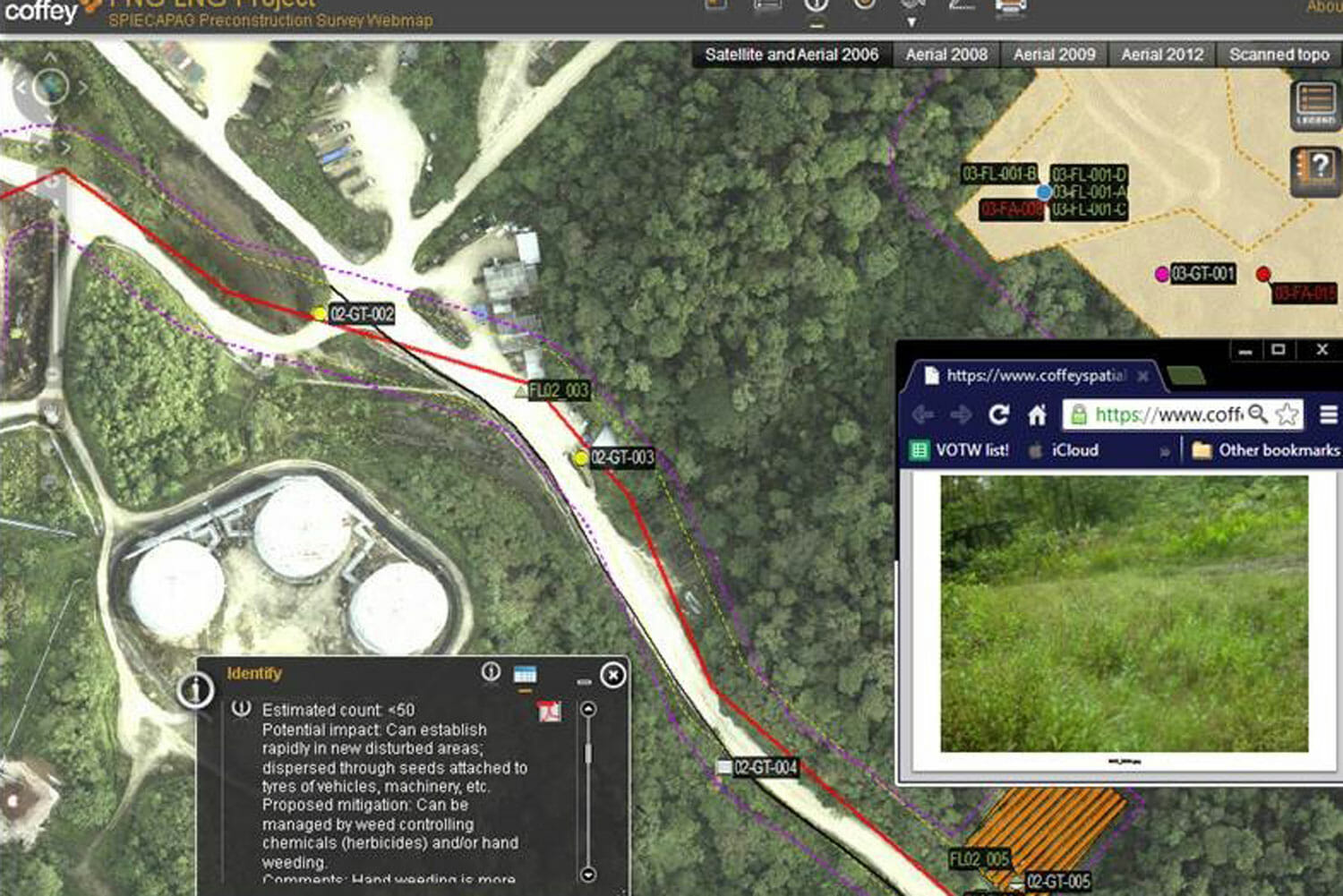
We also built, managed and maintained a data rich WebGIS for the onshore pipeline construction contractor, Spiecapag. The WebGIS allowed secure online viewing and interrogation of a large amount of complex field-captured environmental, social, cultural, and geotechnical sensitivities. The WebGIS was the single-point-of-truth and created many decision-making and communication efficiencies over the two years that it was active.

Client name: ExxonMobil and Spiecapag
Location: Southern Highlands, Papua New Guinea
Duration: 2005 – ongoing
Services provided: Project GIS, WebGIS, Field GIS, Mapping, Figure production, Training