The Victorian Murray Floodplain Restoration Project aims to deliver much needed water back into nine high-value floodplains along the Murray River. Without this water, these iconic landscapes will continue to decline along with many native trees, animals and plants that depend on them.
In 2021, the Victoria State Government selected Tetra Tech Coffey to provide GIS services for the Victorian Murray Floodplain Restoration Project. Here Geospatial Leader, Principal Geospatial Consultant Grant Young shares his insights into this project.
Tell us a bit about this project?
The Victorian Murray Floodplain Restoration Project (VMFRP) is a series complex water infrastructure projects covering more than 15,000 hectares (37,065 acres) across 1000 kilometres (621 miles) of Murray River from Echuca through to the South Australian Border.
We are working very closely with VMFRP team to provide a centralised one-source-of-truth digital GIS database, and the requests and services relating to this. Our work provides invaluable data visibility and a decision making platform to assist the VMFRP team.
The project is working in partnership with Lower Murray Water, Goulburn-Murray Water, Mallee Catchment Management Authority, North Central Catchment Management Authority, Parks Victoria and the Department of Energy, Environment and Climate Action.
Being a project of national importance, VMFRP is funded by the Australian Government’s Department of Climate Change, Energy, the Environment and Water.
How is technology advancing the project?
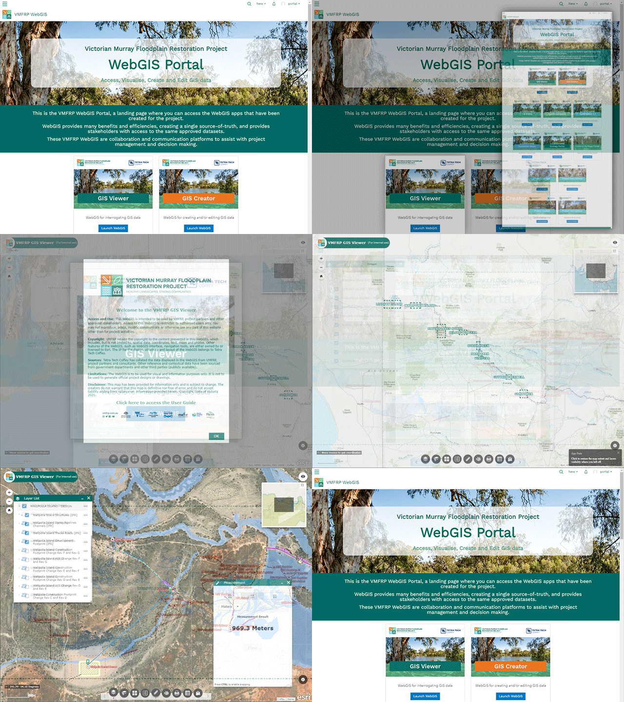
Our role uses GIS technology to bring data and mapping together across a series of large and complex projects. There are many consultants and contractors doing many things on this project, with many of them generating large volumes of spatial data. Data includes ecology, cultural heritage, design, construction tendering and land dealings. We bring all that data and information together and provide an ArcGIS Enterprise GIS solution to host, manage and operate the VMFRP GIS, supporting many project activities.
What additional benefits result from this GIS approach?
The VMFRP GIS is a complete digital dataset and a single system that can be carried from the approvals phase (consisting of two Environment Effects Statements (EES) and two Environment Reports (ER)) into the subsequent construction phase of the project, enabling many benefits and efficiencies along the way.
All data generated for the VMFRP is compiled into this centralised GIS. This central repository then becomes the single source-of-truth for the project, providing data confidence and integrity.
For data access, transparency, and visibility, we spun-up various WebGIS apps for specific audiences and purposes, providing secure online and interactive access to project portals, maps and data. These WebGIS enable all approved stakeholders with the ability to view and interrogate the same approved datasets for assessment and decision making.
From this centralised GIS, we have also deployed Mobile GIS solutions to tablets and smart phones for in-field navigation and capture of field observations, data and geotagged photos and video across all project sites.
The GIS solution delivers many other outputs, including calculations, statistics and spatial analysis requirements.
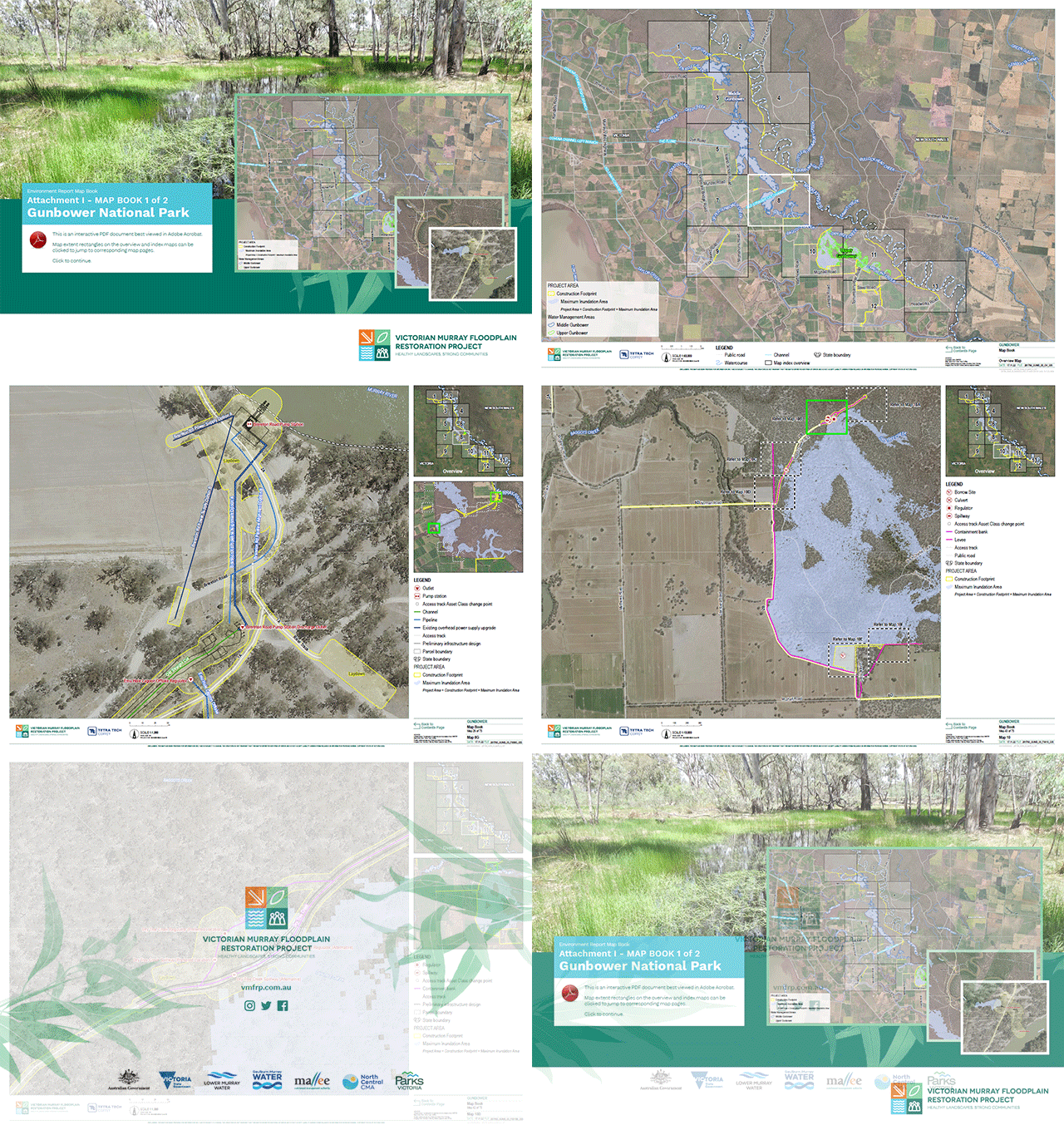
The VMFRP GIS is also used for the production of cartographically correct maps for reports, presentations and other communication materials, including digital interactive and multimedia rich Story Maps.
What are some of the challenges of this project?
VMFRP is a series of large and complex projects, with many partners, stakeholders and timeframes.
Individual projects have their own critical paths, culminating in a VMFRP wide critical path. A centralised GIS has provided efficient, prompt and consistent data access and information assisting to hit the required deadlines and timelines.
Connect with Grant at grant.young@tetratech.com
“Tetra Tech Coffey have been an integral part of the VMFRP team, providing reliable and timely GIS services across all the nine project sites. VMFRP has required a dynamic and agile GIS system to cater for an array of stakeholders. With VMFRP being such a geographically diverse project, one source of truth has been critical to its success.
Tetra Tech Coffey’s role in that success is greatly appreciated.”
VMFRP client feedback, May 2023
